Appenzell Ausserrhoden
(Appenzell Ausserrhoden · Апенцэль — Аўсерродэн · Appenzell Ausser-Rhoden)Canton · Administrative region
Capital: Herisau
Cities & Towns
Top 96 placesAppenzell Ausserrhoden covers 243 km² , divided into 3 districts, with Herisau as its capital city. Around 54 109 people live here, giving a population density of 223 per km² Click a district on the map to open its page.
66 more places in Appenzell Ausserrhoden
Maps & Downloads
SVG and PNG, 600 pxAppenzell Ausserrhoden canton map with district boundaries, Switzerland
Canton boundary with all district borders
Switzerland map with Appenzell Ausserrhoden canton highlighted
All 26 cantons, this one highlighted
Districts
3 districtsAppenzell Ausserrhoden is split into 3 districts. The largest is Hinterland at 136 km², and the smallest is Vorderland at 46 km² Hinterland has the highest building count in OSM, with 10 331 recorded structures.
| District | Population | Area (km²) | Buildings | Postcodes | |
|---|---|---|---|---|---|
| Hinterland | 8 366 | 136 | 10 331 | 12 | Open |
| Mittelland | 16 094 | 60 | 7 687 | 13 | Open |
| Vorderland | 13 706 | 46 | 8 175 | 16 | Open |
Postcodes
36 postcode areasAppenzell Ausserrhoden has 36 postcode areas, covering roughly 1 436 km² and 102 917 mapped buildings. Postcodes in Appenzell Ausserrhoden start with 9 / 3 / 5 (covering 9xxx, 3xxx, 5xxx), placing the canton in these Swiss postal zones. The most built-up postcode is 9050, with around 4 012 buildings. The map shades each postcode area by code number, so you can see at a glance how the Appenzell Ausserrhoden postal zones are laid out geographically.
| # | Code | Name | Buildings | Population | Area km² |
|---|---|---|---|---|---|
| 1 | n/a | 4 012 | 4 272 | 46.11 | |
| 2 | n/a | 3 945 | 9 451 | 5.28 | |
| 3 | n/a | 3 238 | 18 862 | 39.46 | |
| 4 | n/a | 2 870 | 10 491 | 25.2 | |
| 5 | n/a | 1 317 | 13 356 | 7.1 | |
| 6 | n/a | 1 307 | 2 080 | 7.57 | |
| 7 | n/a | 1 124 | 2 337 | 7.47 | |
| 8 | n/a | 1 107 | 3 684 | 11.85 | |
| 9 | n/a | 1 071 | 2 694 | 21.21 | |
| 10 | n/a | 952 | 5 986 | 16.43 | |
| 11 | n/a | 947 | 2 961 | 14.61 | |
| 12 | n/a | 945 | 5 055 | 9.84 | |
| 13 | n/a | 913 | 3 756 | 4.38 | |
| 14 | n/a | 870 | 4 186 | 10.03 | |
| 15 | n/a | 760 | 1 982 | 6.72 | |
| 16 | n/a | 746 | 2 463 | 6.93 | |
| 17 | n/a | 733 | 5 178 | 4.38 | |
| 18 | n/a | 676 | 11 096 | 70.29 | |
| 19 | n/a | 619 | 3 256 | 7.0 | |
| 20 | n/a | 591 | 3 355 | 1.67 |
Appenzell Ausserrhoden has 422 mapped postal facilities: 95 post offices, 323 post boxes, 4 parcel lockers. Swiss Post runs a wide network of branches and automated MyPost 24 parcel lockers across the canton.
Transport
15 lines, 44 routesClick a route on the map to see its details.
Appenzell Ausserrhoden has 336.9 km of public transport routes across 15 lines and 44 services, run by 4 operators.
Full transport breakdownPopulation and Building Density
by municipality (Gemeinde borders)Hover over a municipality to see its figures.
Public Holidays
15 holidays in 2026 & 2027Appenzell Ausserrhoden observes 7 public holidays in 2026. Alongside the Swiss national holidays, Appenzell Ausserrhoden has 3 canton-specific holidays.
| Date | Holiday | Day | Scope |
|---|---|---|---|
| 01.01.2026 | New Year's Day | Thursday | National |
| 03.04.2026 | Good Friday | Friday | Canton |
| 06.04.2026 | Easter Monday | Monday | Canton |
| 14.05.2026 | Ascension Day | Thursday | National |
| 25.05.2026 | Whit Monday | Monday | Canton |
| 01.08.2026 | National Day | Saturday | National |
| 25.12.2026 | Christmas Day | Friday | National |
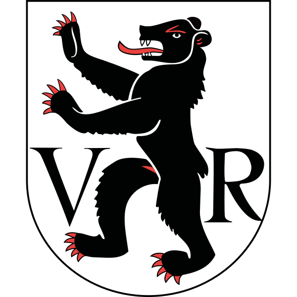
Heraldry
Official heraldry, free to downloadThese are the official heraldic symbols of Appenzell Ausserrhoden. The images come from Wikimedia Commons and can be downloaded below in SVG (scales to any size) or PNG (600 x 600 px).

Questions about Appenzell Ausserrhoden
Quick answersWhat is the capital city of Appenzell Ausserrhoden?
The capital of Appenzell Ausserrhoden is Herisau, with around 15 943 residents.
How many people live in Appenzell Ausserrhoden?
Around 54 109 people call Appenzell Ausserrhoden home, spread across 243 km².
How big is Appenzell Ausserrhoden?
Appenzell Ausserrhoden takes up 243 km², which is roughly 94 square miles.
Is Appenzell Ausserrhoden a canton or a city?
Appenzell Ausserrhoden is a canton, one of 26 member states of the Swiss Confederation. Each one has its own constitution, parliament, government, and courts. Its administrative capital is Herisau.
What language is spoken in Appenzell Ausserrhoden?
The official language of Appenzell Ausserrhoden is German.
How many districts does Appenzell Ausserrhoden have?
Appenzell Ausserrhoden is divided into 3 districts (Bezirke). These include Hinterland, Mittelland, Vorderland , each forming a second-level administrative subdivision of the canton.
What postal codes does Appenzell Ausserrhoden use?
Appenzell Ausserrhoden uses 36 postal code areas. Swiss codes are always 4 digits long. Codes here start with 9, 3, 5.