Basel-Landschaft
(Basel-Landschaft · Базель-Ланд · Basilea-Camp)Canton · Administrative region
Capital: Liestal
Cities & Towns
Top 100 placesBasel-Landschaft covers 518 km² , divided into 5 districts, with Liestal as its capital city. Around 273 231 people live here, giving a population density of 528 per km² The largest city is Allschwil, with 20 249 residents. Click a district on the map to open its page.
70 more places in Basel-Landschaft
Maps & Downloads
SVG and PNG, 600 pxBasel-Landschaft canton map with district boundaries, Switzerland
Canton boundary with all district borders
Switzerland map with Basel-Landschaft canton highlighted
All 26 cantons, this one highlighted
Districts
5 districtsBasel-Landschaft is split into 5 districts. The largest is Bezirk Sissach at 141 km², and the smallest is Bezirk Liestal at 86 km² Bezirk Arlesheim has the highest building count in OSM, with 67 293 recorded structures.
| District | Population | Area (km²) | Buildings | Postcodes | |
|---|---|---|---|---|---|
| Bezirk Sissach | 32 243 | 141 | 29 202 | 32 | Open |
| Bezirk Waldenburg | 15 344 | 105 | 13 062 | 18 | Open |
| Bezirk Arlesheim | 151 754 | 96 | 67 293 | 21 | Open |
| Bezirk Laufen | 16 376 | 90 | 16 886 | 16 | Open |
| Bezirk Liestal | 43 707 | 86 | 34 053 | 18 | Open |
Postcodes
96 postcode areasBasel-Landschaft has 96 postcode areas, covering roughly 1 872 km² and 407 882 mapped buildings. Postcodes in Basel-Landschaft start with 4 / 2 (covering 4xxx, 2xxx), placing the canton in these Swiss postal zones. The most built-up postcode is 4153, with around 5 870 buildings. The map shades each postcode area by code number, so you can see at a glance how the Basel-Landschaft postal zones are laid out geographically.
| # | Code | Name | Buildings | Population | Area km² |
|---|---|---|---|---|---|
| 1 | n/a | 5 870 | 20 466 | 6.97 | |
| 2 | n/a | 5 768 | 16 009 | 16.65 | |
| 3 | n/a | 5 126 | 20 881 | 8.89 | |
| 4 | n/a | 4 664 | 10 122 | 18.18 | |
| 5 | n/a | 4 312 | 18 060 | 10.7 | |
| 6 | n/a | 4 065 | 6 184 | 7.19 | |
| 7 | n/a | 3 792 | 14 488 | 4.46 | |
| 8 | n/a | 3 771 | 11 665 | 7.88 | |
| 9 | n/a | 3 277 | 5 480 | 7.4 | |
| 10 | n/a | 3 220 | 5 783 | 7.66 | |
| 11 | n/a | 2 708 | 21 774 | 6.93 | |
| 12 | n/a | 2 632 | 18 896 | 3.75 | |
| 13 | n/a | 2 515 | 5 534 | 9.78 | |
| 14 | n/a | 2 300 | 14 285 | 1.94 | |
| 15 | n/a | 2 254 | 8 845 | 8.9 | |
| 16 | n/a | 2 161 | 2 748 | 3.0 | |
| 17 | n/a | 2 055 | 5 469 | 11.39 | |
| 18 | n/a | 1 963 | 5 040 | 5.57 | |
| 19 | n/a | 1 903 | 11 632 | 2.51 | |
| 20 | n/a | 1 842 | 2 355 | 10.8 |
Basel-Landschaft has 1153 mapped postal facilities: 124 post offices, 995 post boxes, 34 parcel lockers. Swiss Post runs a wide network of branches and automated MyPost 24 parcel lockers across the canton.
Transport
49 lines, 158 routesClick a route on the map to see its details.
Basel-Landschaft has 1540.8 km of public transport routes across 49 lines and 158 services, run by 7 operators.
Full transport breakdownPopulation and Building Density
by municipality (Gemeinde borders)Hover over a municipality to see its figures.
Public Holidays
18 holidays in 2026 & 2027Basel-Landschaft observes 9 public holidays in 2026. Alongside the Swiss national holidays, Basel-Landschaft has 5 canton-specific holidays.
| Date | Holiday | Day | Scope |
|---|---|---|---|
| 01.01.2026 | New Year's Day | Thursday | National |
| 03.04.2026 | Good Friday | Friday | Canton |
| 06.04.2026 | Easter Monday | Monday | Canton |
| 01.05.2026 | Labor Day | Friday | Canton |
| 14.05.2026 | Ascension Day | Thursday | National |
| 25.05.2026 | Whit Monday | Monday | Canton |
| 01.08.2026 | National Day | Saturday | National |
| 25.12.2026 | Christmas Day | Friday | National |
| 26.12.2026 | Saint Stephen's Day | Saturday | Canton |
Heraldry
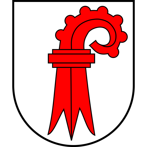
Official heraldry, free to downloadThese are the official heraldic symbols of Basel-Landschaft. The images come from Wikimedia Commons and can be downloaded below in SVG (scales to any size) or PNG (600 x 600 px).

Questions about Basel-Landschaft
Quick answersWhat is the capital city of Basel-Landschaft?
The capital of Basel-Landschaft is Liestal, with around 13 807 residents.
How many people live in Basel-Landschaft?
Around 273 231 people call Basel-Landschaft home, spread across 518 km².
How big is Basel-Landschaft?
Basel-Landschaft takes up 518 km², which is roughly 200 square miles.
Is Basel-Landschaft a canton or a city?
Basel-Landschaft is a canton, one of 26 member states of the Swiss Confederation. Each one has its own constitution, parliament, government, and courts. Its administrative capital is Liestal.
What language is spoken in Basel-Landschaft?
The official language of Basel-Landschaft is German.
How many districts does Basel-Landschaft have?
Basel-Landschaft is divided into 5 districts (Bezirke). These include Bezirk Sissach, Bezirk Waldenburg, Bezirk Arlesheim, Bezirk Laufen, Bezirk Liestal , each forming a second-level administrative subdivision of the canton.
What postal codes does Basel-Landschaft use?
Basel-Landschaft uses 96 postal code areas. Swiss codes are always 4 digits long. Codes here start with 4, 2.