Bezirk Thierstein
(Bezirk Thierstein · Bezirk Thierstein · Тирштайн)District (Bezirk) · Administrative level 6 · Solothurn
Main town: Breitenbach
Cities & Towns
Showing top 30 of 18 placesThe district of Bezirk Thierstein spans 102 km² and contains 12 municipalities, with Breitenbach as its main town. Its estimated population of 14 862 gives a density of 145 /km² Hover over municipalities on the map to explore the district.
Maps & Downloads
SVG · PNG · 600 pxBezirk Thierstein district map with municipality boundaries, Switzerland
District outline with municipality boundaries
Solothurn canton map with Bezirk Thierstein district highlighted, Switzerland
District highlighted in its canton context
Municipalities / Gemeinden
12 municipalitiesBezirk Thierstein contains 12 municipalities (Gemeinden). The largest is Beinwil (SO) at 23 km², the smallest is Fehren (2 km²) Breitenbach has the most mapped buildings (1 558 in OSM).
| Municipality | Population | Area km² | Buildings | Postcodes | |
|---|---|---|---|---|---|
| Beinwil (SO) | 271 | 23 | 395 | 3 | - |
| Kleinlützel | 1 259 | 16 | 960 | 2 | - |
| Bärschwil | 808 | 11 | 647 | 1 | - |
| Nunningen | 1 973 | 10 | 1 167 | 1 | - |
| Büsserach | 2 084 | 8 | 1 127 | 1 | - |
| Erschwil | 892 | 7 | 634 | 1 | - |
| Breitenbach | - | 7 | 1 558 | 2 | - |
| Himmelried | 947 | 6 | 609 | 2 | - |
| Meltingen | 645 | 6 | 373 | 2 | - |
| Zullwil | 626 | 4 | 420 | 1 | - |
| Grindel | 458 | 3 | 331 | 1 | - |
| Fehren | 595 | 2 | 368 | 2 | - |
Postcodes
17 postcode areasThe district of Bezirk Thierstein is served by 17 postcode areas covering roughly 366 km² with a total of 11 863 mapped buildings. Postcodes in Bezirk Thierstein begin with the digits 4, 2 (i.e.), placing the district in these Swiss postal zones. The most built-up postcode is 4208, with approximately 1 001 buildings. The map colours each postcode area by its numerical code, with lower codes in blue/purple and higher codes in orange.
| # | Code | Name | Buildings | Population | Area km² | |
|---|---|---|---|---|---|---|
| 1 | - | 1 001 | 2 234 | 10.31 | View → | |
| 2 | - | 867 | 868 | 9.42 | View → | |
| 3 | - | 861 | 4 077 | 16.31 | View → | |
| 4 | - | 527 | 1 936 | 10.79 | View → | |
| 5 | - | 481 | 408 | 6.02 | View → | |
| 6 | - | 416 | 1 443 | 16.31 | View → | |
| 7 | - | 302 | 208 | 1.48 | View → | |
| 8 | - | 272 | 1 173 | 15.3 | View → | |
| 9 | - | 270 | 172 | 6.8 | View → | |
| 10 | - | 233 | 536 | 3.08 | View → | |
| 11 | - | 187 | 1 222 | 14.91 | View → | |
| 12 | - | 183 | 1 482 | 8.53 | View → | |
| 13 | - | 147 | 2 114 | 22.66 | View → | |
| 14 | - | 35 | 276 | 5.76 | View → | |
| 15 | - | 30 | 1 142 | 3.66 | View → | |
| 16 | - | 28 | 3 033 | 11.19 | View → | |
| 17 | - | 3 | 2 275 | 7.55 | View → |
Bezirk Thierstein has 46 mapped postal facilities: 6 post offices, 40 post boxes. Swiss Post (Die Schweizerische Post) runs a dense network of branches and automated MyPost 24 parcel lockers across the district.
Transport
2 lines · 5 routesClick any route on the map to see details.
Bezirk Thierstein's public transport network covers 50.3 km across 2 lines and 5 routes, operated by 1 operator.
Full transport detailsDensity by Municipality
actual Gemeinde bordersHover over a municipality to see exact values.
Heraldry
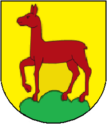
Coat of ArmsThe official heraldic symbols of Bezirk Thierstein district. Images are sourced from Wikimedia Commons and can be downloaded in SVG and PNG formats.
Frequently Asked Questions about Bezirk Thierstein
Quick answersWhat is the main town of Bezirk Thierstein district?
The main town of Bezirk Thierstein district is Breitenbach, with a population of about 4,304 residents.
Which canton does Bezirk Thierstein belong to?
Bezirk Thierstein is a district (Bezirk) within the canton of Solothurn, one of the 26 cantons of Switzerland.
Is Bezirk Thierstein a district or a city?
Bezirk Thierstein is a district (Bezirk) in the canton of Solothurn in Switzerland. Districts sit between the canton level and the municipality (Gemeinde) level and are used for administrative, judicial, and statistical purposes. The main town within Bezirk Thierstein is Breitenbach.
What is the population of Bezirk Thierstein?
Bezirk Thierstein district has a population of about 14 862 residents, giving a population density of 145 people per km².
How large is Bezirk Thierstein district?
Bezirk Thierstein covers a total area of 102 km² (about 39 square miles).
How many municipalities are in Bezirk Thierstein?
Bezirk Thierstein district contains 12 municipalities (Gemeinden): Beinwil (SO), Kleinlützel, Bärschwil, Nunningen, Büsserach, Erschwil, Breitenbach, Himmelried and 4 more
What postal codes are used in Bezirk Thierstein?
Bezirk Thierstein has 17 postal code areas. Swiss postal codes are 4 digits long; codes here typically begin with 4, 2.
How many buildings are in Bezirk Thierstein?
According to OpenStreetMap data, Bezirk Thierstein district has 8 589 mapped buildings, a density of 84 buildings per km².