Saint-Maurice
(Saint-Maurice · St-Maurice · Saint-Maurice)District (Bezirk) · Administrative level 6 · Valais/Wallis
Main town: Saint-Maurice
Cities & Towns
Showing top 30 of 33 placesThe district of Saint-Maurice spans 191 km² and contains 9 municipalities, with Saint-Maurice as its main town. Its estimated population of 10 212 gives a density of 54 /km² Hover over municipalities on the map to explore the district.
... and 3 more places in Saint-Maurice
Maps & Downloads
SVG · PNG · 600 pxSaint-Maurice district map with municipality boundaries, Switzerland
District outline with municipality boundaries
Valais/Wallis canton map with Saint-Maurice district highlighted, Switzerland
District highlighted in its canton context
Municipalities / Gemeinden
9 municipalitiesSaint-Maurice contains 9 municipalities (Gemeinden). The largest is Salvan at 54 km², the smallest is Vernayaz (6 km²) Saint-Maurice has the most mapped buildings (1 669 in OSM).
| Municipality | Population | Area km² | Buildings | Postcodes | |
|---|---|---|---|---|---|
| Salvan | - | 54 | 1 555 | 2 | - |
| Evionnaz | - | 48 | 691 | 1 | - |
| Finhaut | 445 | 23 | 810 | 1 | - |
| Saint-Maurice | 4 659 | 15 | 1 669 | 2 | View |
| Vérossaz | 712 | 14 | 553 | 1 | - |
| Dorénaz | - | 13 | 569 | 1 | - |
| Collonges | 723 | 12 | 481 | 1 | - |
| Massongex | 1 787 | 7 | 739 | 2 | - |
| Vernayaz | 1 886 | 6 | 1 300 | 2 | - |
Postcodes
12 postcode areasThe district of Saint-Maurice is served by 12 postcode areas covering roughly 569 km² with a total of 23 034 mapped buildings. Postcodes in Saint-Maurice begin with the digit 1 (i.e.), placing the district in this Swiss postal zone. The most built-up postcode is 1920, with approximately 3 707 buildings. The map colours each postcode area by its numerical code, with lower codes in blue/purple and higher codes in orange.
| # | Code | Name | Buildings | Population | Area km² | |
|---|---|---|---|---|---|---|
| 1 | - | 3 707 | 11 928 | 21.6 | View → | |
| 2 | - | 1 144 | 1 213 | 14.92 | View → | |
| 3 | - | 946 | 4 185 | 8.91 | View → | |
| 4 | - | 689 | - | 11.36 | View → | |
| 5 | - | 636 | 3 320 | 6.01 | View → | |
| 6 | - | 553 | - | 42.11 | View → | |
| 7 | - | 445 | 763 | 6.64 | View → | |
| 8 | - | 428 | 3 446 | 48.07 | View → | |
| 9 | - | 410 | 445 | 22.85 | View → | |
| 10 | - | 350 | - | 12.58 | View → | |
| 11 | - | 331 | 712 | 14.29 | View → | |
| 12 | - | 306 | 723 | 12.2 | View → |
Saint-Maurice has 108 mapped postal facilities: 18 post offices, 86 post boxes, 4 parcel lockers. Swiss Post (Die Schweizerische Post) runs a dense network of branches and automated MyPost 24 parcel lockers across the district.
Transport
5 lines · 12 routesClick any route on the map to see details.
Saint-Maurice's public transport network covers 37.7 km across 5 lines and 12 routes, operated by 2 operators.
Full transport detailsDensity by Municipality
actual Gemeinde bordersHover over a municipality to see exact values.
Heraldry
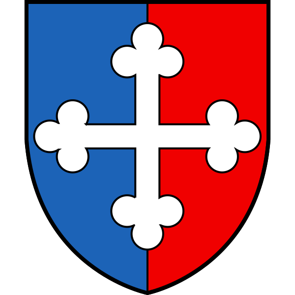
Coat of ArmsThe official heraldic symbols of Saint-Maurice district. Images are sourced from Wikimedia Commons and can be downloaded in SVG and PNG formats.
Frequently Asked Questions about Saint-Maurice
Quick answersWhat is the main town of Saint-Maurice district?
The main town of Saint-Maurice district is Saint-Maurice, with a population of about 4,516 residents.
Which canton does Saint-Maurice belong to?
Saint-Maurice is a district (Bezirk) within the canton of Valais/Wallis, one of the 26 cantons of Switzerland.
Is Saint-Maurice a district or a city?
Saint-Maurice is a district (Bezirk) in the canton of Valais/Wallis in Switzerland. Districts sit between the canton level and the municipality (Gemeinde) level and are used for administrative, judicial, and statistical purposes. The main town within Saint-Maurice is Saint-Maurice.
What is the population of Saint-Maurice?
Saint-Maurice district has a population of about 10 212 residents, giving a population density of 54 people per km².
How large is Saint-Maurice district?
Saint-Maurice covers a total area of 191 km² (about 74 square miles).
How many municipalities are in Saint-Maurice?
Saint-Maurice district contains 9 municipalities (Gemeinden): Salvan, Evionnaz, Finhaut, Saint-Maurice, Vérossaz, Dorénaz, Collonges, Massongex and 1 more
What postal codes are used in Saint-Maurice?
Saint-Maurice has 12 postal code areas. Swiss postal codes are 4 digits long; codes here typically begin with 1.
How many buildings are in Saint-Maurice?
According to OpenStreetMap data, Saint-Maurice district has 8 367 mapped buildings, a density of 44 buildings per km².